
Wanna join for a trek ?
And with that weekend plans were made to trek Kudremukh with Madventures (a new travel group of a friend,now that I know him.They are good – check them out). There was a teeny weeny doubt on back of my mind if I would enjoy the company of strangers.It was laid to rest as the journey began. The mutual dislike to Yo Yo Honey Singh bonded us all. College stories,mallu-ism and random chit chat kept us awake throughout the night.Well almost.
Six kms of a bumpy uphill ride from the main road of Mullodi in the jeep,we reached our guide’s house around 6.30 am.It’s a traditional village house with basic amenities. A home far away from home. A quick breakfast and we were off to explore and conquer the beautiful hills of Kudremukh. Since this is a protected forest, one needs to take prior permission from the forest office at Kudremukh town. Also you cannot camp over the top. Therefore one has to trek the entire 20km odd km in a single day. The trek starts with rocky path leading you to shady forests with river streams and then to beautiful open valleys. The terrain varies between the three through out except for the last leg of steep rocky climb.
The name of the peak Kudremukh is kept so since it resembles a Horse’s face. It never resembled anything to me!

Peak at the back

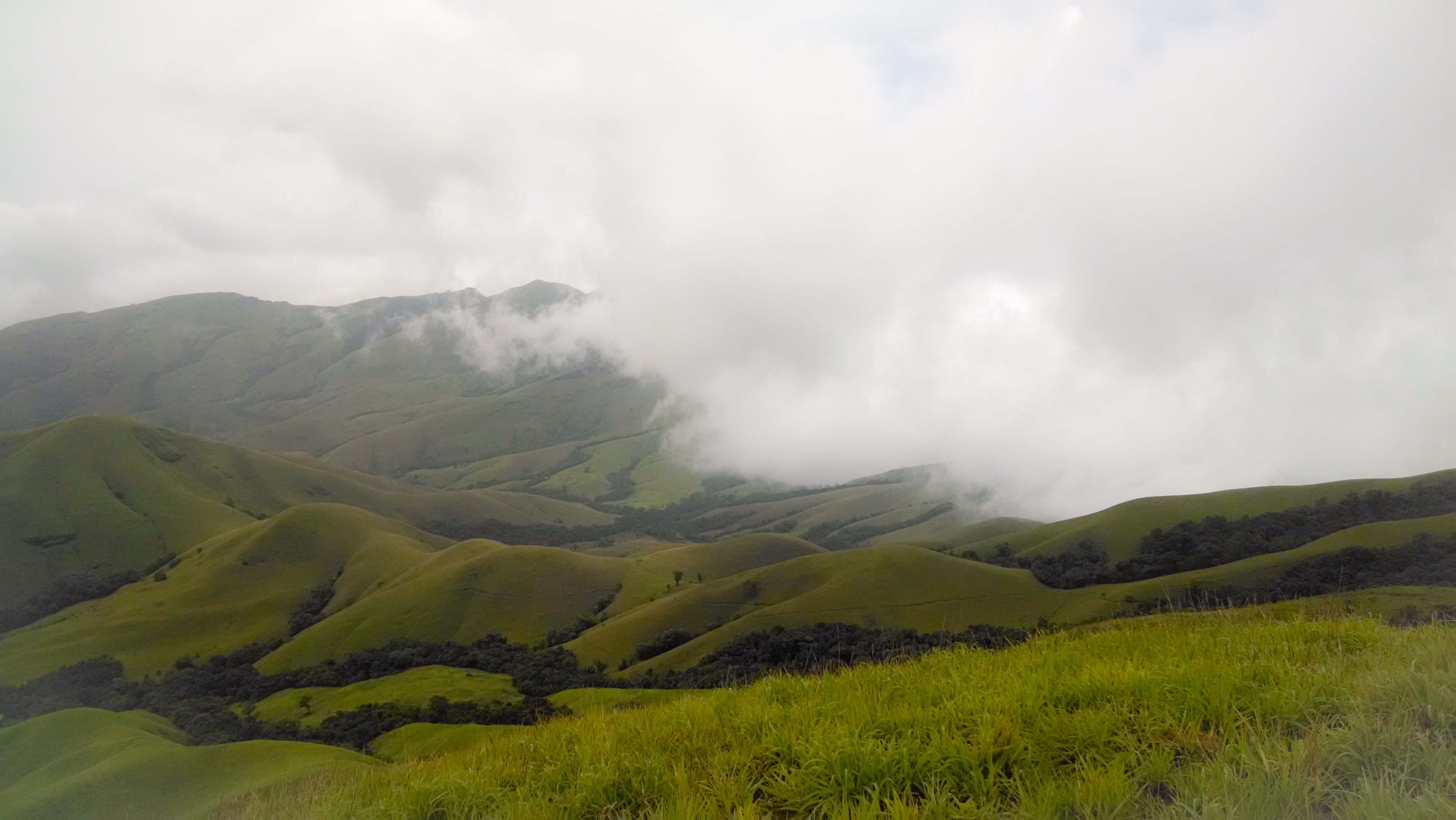
The weather was cool and sky was filled with clouds. The green strip spread across the hills surrounded by clouds makes the view spectacular and leaves one speechless. It is indeed one of the most beautiful treks in South India.
Snap during the ascent

Panoramic shot from MotoX. Yes it rocks!
We broke for lunch by the stream.By the time we reached the peak it was around 1.30 pm. Though tired,all were nonetheless happy to have climbed the second tallest peak in Karnataka at 1894 m. We were completely surrounded by the clouds and couldn’t see anything. Lying down amidst the clouds is an experience of one of the kind.

Guide resting on the top

Clouds,clouds and clouds!
 Yayyy! We climbed the goddamm mountain
We began the descent around 2.45 pm since it started drizzling. This being my first trek, the pain began to spread half way through.It was little scary as one edge of the valley opens to hundreds of feet below.The last 3 kms were irritating and test of patience. Cheta’s company made it fun and bearable.We finally made it and reached our guide’s house at 6 pm. Hot bath followed by delicious local meal soothed both body and soul.
As they say, The trek is always glamorous in retrospect.
Details :
Route: Bangalore – Chikmagalur – Kalasa – Mullodi village(start point of the trek)
Total Trek Distance = 10 + 10 -> 20 km app
Difficulty Level = Moderate

Leave a comment